
Current data KAISERBURG NUERNBERG
Groundwater level [m above sealevel]: 303.49
Distance to surface [m]: 44.17
Last value from 11.07.2026 10:00
Ground level [m above sealevel]: 347.66
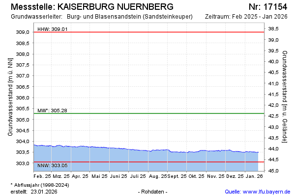
| Date | Groundwater level [m above sealevel] |
|---|---|
| 11.07.2026 | 303.49 |
| 10.07.2026 | 303.49 |
| 09.07.2026 | 303.49 |
| 08.07.2026 | 303.50 |
| 07.07.2026 | 303.48 |
| 06.07.2026 | 303.49 |
| 05.07.2026 | 303.48 |
| 04.07.2026 | 303.49 |