
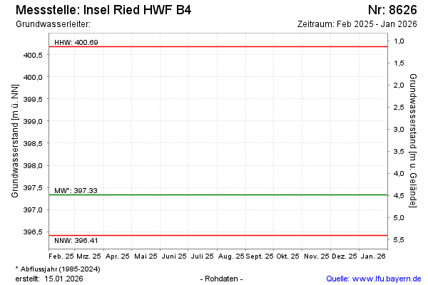
Current data Insel Ried HWF B4
Groundwater level [m above sealevel]: 397.04
Distance to surface [m]: 4.78
Last value from 18.11.2025 16:00
Ground level [m above sealevel]: 401.82
| Date | Groundwater level [m above sealevel] |
|---|---|
| 31.10.2024 | 397.28 |
| 06.03.2024 | 397.95 |
| 04.04.2023 | 397.27 |
| 07.07.2022 | 396.71 |
| 03.03.2021 | 397.05 |
| 20.02.2020 | 397.64 |
| 24.01.2019 | 397.14 |
| 02.03.2018 | 399.16 |