
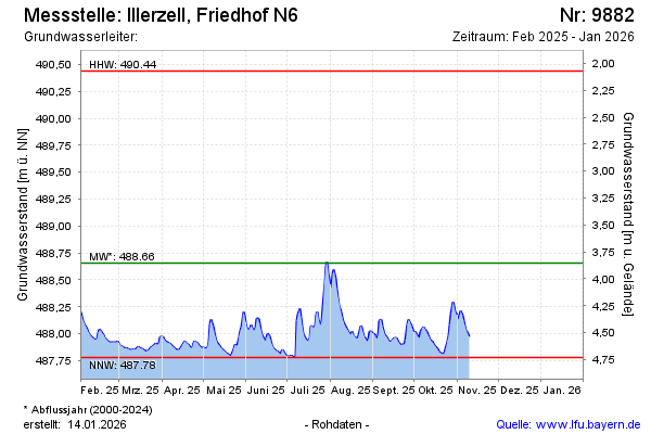
Current data Illerzell, Friedhof N6
Groundwater level [m above sealevel]: 488.07
Distance to surface [m]: 4.44
Last value from 13.05.2026 10:25
Ground level [m above sealevel]: 492.51
| Date | Groundwater level [m above sealevel] |
|---|---|
| 13.05.2026 | 488.07 |
| 12.05.2026 | 488.04 |
| 11.05.2026 | 488.02 |
| 10.05.2026 | 488.02 |
| 09.05.2026 | 488.03 |
| 08.05.2026 | 488.04 |
| 07.05.2026 | 488.04 |
| 06.05.2026 | 488.06 |