
- Start >
- Groundwater >
- Waterlevel of upper layer >
- Obere Donau >
- ILLERTISSEN 2204 >
- Chart of total period

Chart of total period ILLERTISSEN 2204
Groundwater levels of the total period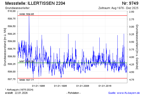
Groundwater level [m above sealevel]: 508.23
Distance to surface [m]: 4.25
Last value from 16.04.2024 10:07
Ground level [m above sealevel]: 512.48
| Date | Groundwater level [m above sealevel] |
|---|---|
| 16.04.2024 | 508.23 |
| 15.04.2024 | 508.22 |
| 14.04.2024 | 508.22 |
| 13.04.2024 | 508.23 |
| 12.04.2024 | 508.24 |
| 11.04.2024 | 508.24 |
| 10.04.2024 | 508.24 |
| 09.04.2024 | 508.25 |
© Bayerisches Landesamt für Umwelt 2024