
- Start >
- Groundwater >
- Waterlevel of upper layer >
- Obere Donau >
- Hygstetterhof, GWM 17-5 >
- Chart of total period

Chart of total period Hygstetterhof, GWM 17-5
Groundwater levels of the total period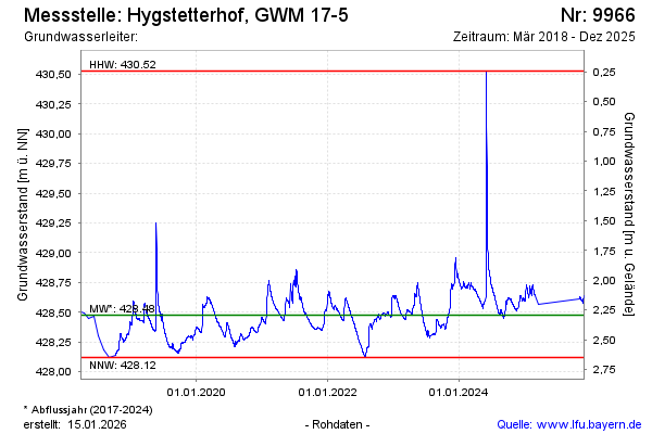
Groundwater level [m above sealevel]: 428.66
Distance to surface [m]: 2.11
Last value from 11.04.2024 07:42
Ground level [m above sealevel]: 430.77
| Date | Groundwater level [m above sealevel] |
|---|---|
| 11.04.2024 | 428.66 |
| 10.04.2024 | 428.66 |
| 09.04.2024 | 428.67 |
| 08.04.2024 | 428.67 |
| 07.04.2024 | 428.67 |
| 06.04.2024 | 428.68 |
| 05.04.2024 | 428.68 |
| 04.04.2024 | 428.68 |
© Bayerisches Landesamt für Umwelt 2024