
- Start >
- Groundwater >
- Waterlevel of upper layer >
- Obere Donau >
- HWF-DONAUWOERTH P5 >
- Chart of total period

Chart of total period HWF-DONAUWOERTH P5
Groundwater levels of the total period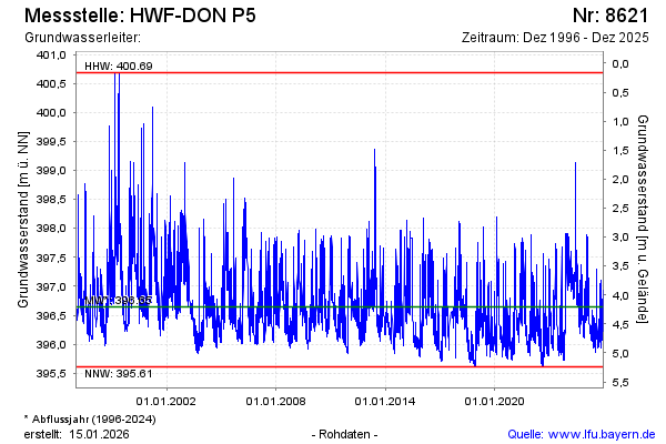
Groundwater level [m above sealevel]: 395.99
Distance to surface [m]: 4.86
Last value from 22.01.2026 15:03
Ground level [m above sealevel]: 400.85
| Date | Groundwater level [m above sealevel] |
|---|---|
| 22.01.2026 | 396.01 |
| 21.01.2026 | 396.02 |
| 20.01.2026 | 396.05 |
| 19.01.2026 | 396.07 |
| 18.01.2026 | 396.09 |
| 17.01.2026 | 396.14 |
| 16.01.2026 | 396.14 |
| 15.01.2026 | 396.14 |
© Bayerisches Landesamt für Umwelt 2026