
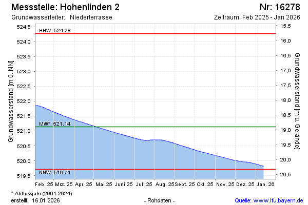
Current data Hohenlinden 2
Groundwater level [m above sealevel]: 519.51
Distance to surface [m]: 20.53
Last value from 24.06.2026 10:00
Ground level [m above sealevel]: 540.04
| Date | Groundwater level [m above sealevel] |
|---|---|
| 30.06.2026 | 519.49 |
| 29.06.2026 | 519.49 |
| 28.06.2026 | 519.50 |
| 27.06.2026 | 519.50 |
| 26.06.2026 | 519.50 |
| 25.06.2026 | 519.51 |
| 24.06.2026 | 519.51 |
| 23.06.2026 | 519.51 |