
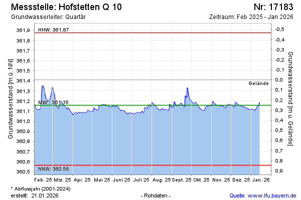
Current data Hofstetten Q 10
Groundwater level [m above sealevel]: 361.12
Distance to surface [m]: 0.29000000000002
Last value from 17.06.2026 09:51
Ground level [m above sealevel]: 361.41
| Date | Groundwater level [m above sealevel] |
|---|---|
| 17.06.2026 | 361.12 |
| 16.06.2026 | 361.12 |
| 15.06.2026 | 361.12 |
| 14.06.2026 | 361.13 |
| 13.06.2026 | 361.14 |
| 12.06.2026 | 361.14 |
| 11.06.2026 | 361.14 |
| 10.06.2026 | 361.13 |