Year chart of precipitation Herrieden
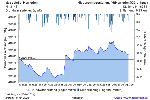
Groundwater level [m above sealevel]: 418,15
Distance to surface [m]: 1,55
Last value from 23.07.2026 01:00
Ground level [m above sealevel]: 419.70

Groundwater level [m above sealevel]: 418,15
Distance to surface [m]: 1,55
Last value from 23.07.2026 01:00
Ground level [m above sealevel]: 419.70