
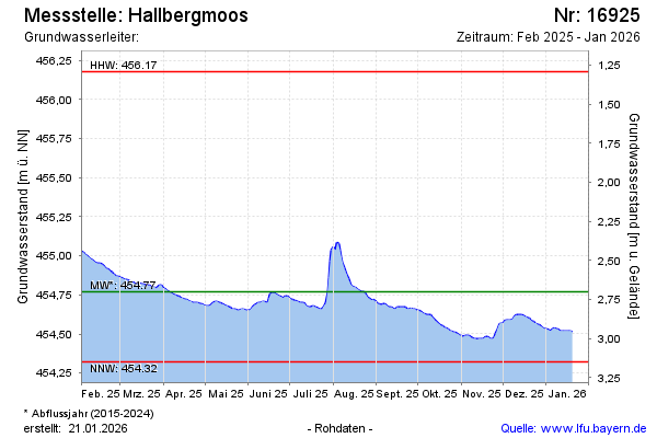
Current data Hallbergmoos
Groundwater level [m above sealevel]: 454.63
Distance to surface [m]: 2.84
Last value from 24.06.2026 13:00
Ground level [m above sealevel]: 457.47
| Date | Groundwater level [m above sealevel] |
|---|---|
| 27.06.2026 | 454.63 |
| 26.06.2026 | 454.62 |
| 25.06.2026 | 454.63 |
| 24.06.2026 | 454.63 |
| 23.06.2026 | 454.63 |
| 22.06.2026 | 454.63 |
| 21.06.2026 | 454.63 |
| 20.06.2026 | 454.63 |