
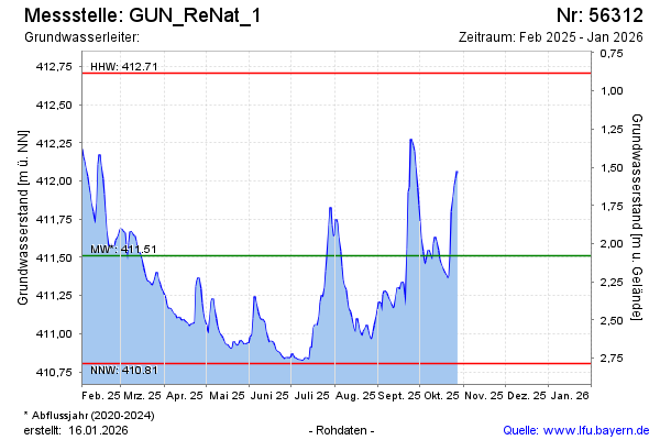
Current data GUN_ReNat_1
Groundwater level [m above sealevel]: 410.88
Distance to surface [m]: 2.71
Last value from 03.06.2026 09:59
Ground level [m above sealevel]: 413.59
| Date | Groundwater level [m above sealevel] |
|---|---|
| 03.06.2026 | 410.89 |
| 02.06.2026 | 410.87 |
| 01.06.2026 | 410.88 |
| 31.05.2026 | 410.84 |
| 30.05.2026 | 410.83 |
| 29.05.2026 | 410.85 |
| 28.05.2026 | 410.86 |
| 27.05.2026 | 410.88 |