
- Start >
- Groundwater >
- Waterlevel of upper layer >
- Obere Donau >
- Großhabersdorf Q 12 >
- Chart of total period

Chart of total period Großhabersdorf Q 12
Groundwater levels of the total period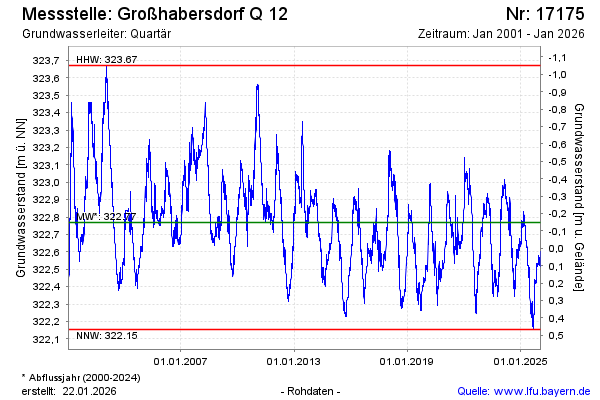
Groundwater level [m above sealevel]: 322.81
Distance to surface [m]: -0.19
Last value from 29.04.2024 23:00
Ground level [m above sealevel]: 322.62
| Date | Groundwater level [m above sealevel] |
|---|---|
| 29.04.2024 | 322.81 |
| 28.04.2024 | 322.83 |
| 27.04.2024 | 322.84 |
| 26.04.2024 | 322.85 |
| 25.04.2024 | 322.86 |
| 24.04.2024 | 322.87 |
| 23.04.2024 | 322.87 |
| 22.04.2024 | 322.88 |
© Bayerisches Landesamt für Umwelt 2024