
- Start >
- Groundwater >
- Waterlevel of upper layer >
- Obere Donau >
- GROSSAITINGEN BHF 92 >
- Chart of total period

Chart of total period GROSSAITINGEN BHF 92
Groundwater levels of the total period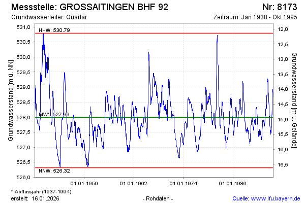
Groundwater level [m above sealevel]: 528.65
Distance to surface [m]: 14.28
Last value from 30.10.1995 12:00
Ground level [m above sealevel]: 542.93
| Date | Groundwater level [m above sealevel] |
|---|---|
| 23.10.1995 | 528.68 |
| 16.10.1995 | 528.69 |
| 09.10.1995 | 528.73 |
| 02.10.1995 | 528.77 |
| 25.09.1995 | 528.80 |
| 18.09.1995 | 528.88 |
| 11.09.1995 | 528.89 |
| 04.09.1995 | 528.93 |
© Bayerisches Landesamt für Umwelt 2026