
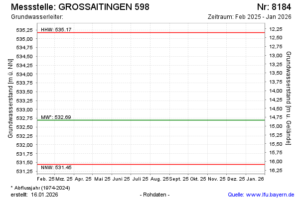
Current data GROSSAITINGEN 598
Groundwater level [m above sealevel]: 531.71
Distance to surface [m]: 15.82
Last value from 15.12.2025 10:00
Ground level [m above sealevel]: 547.53
| Date | Groundwater level [m above sealevel] |
|---|---|
| 04.12.2024 | 533.82 |
| 01.07.2024 | 534.15 |
| 14.12.2023 | 532.26 |
| 15.06.2023 | 531.86 |
| 01.12.2022 | 531.68 |
| 15.06.2022 | 532.01 |
| 09.12.2021 | 532.96 |
| 19.07.2021 | 532.30 |