
- Start >
- Groundwater >
- Waterlevel of upper layer >
- Obere Donau >
- GROEBENZELL 286 A >
- Chart of total period

Chart of total period GROEBENZELL 286 A
Groundwater levels of the total period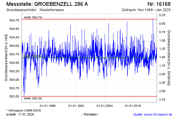
Groundwater level [m above sealevel]: 503.60
Distance to surface [m]: 1.56
Last value from 21.05.2026 06:00
Ground level [m above sealevel]: 505.16
| Date | Groundwater level [m above sealevel] |
|---|---|
| 20.05.2026 | 503.60 |
| 19.05.2026 | 503.60 |
| 18.05.2026 | 503.58 |
| 17.05.2026 | 503.58 |
| 16.05.2026 | 503.59 |
| 15.05.2026 | 503.59 |
| 14.05.2026 | 503.59 |
| 13.05.2026 | 503.61 |
© Bayerisches Landesamt für Umwelt 2026