
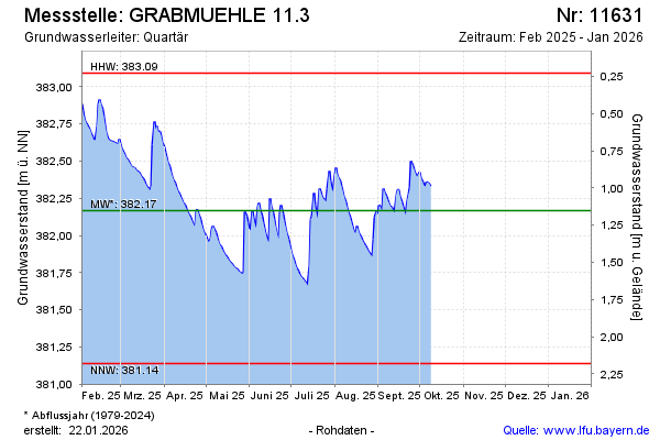
Current data GRABMUEHLE 11.3
Groundwater level [m above sealevel]: 382.21
Distance to surface [m]: 1.11
Last value from 15.04.2026 14:00
Ground level [m above sealevel]: 383.32
| Date | Groundwater level [m above sealevel] |
|---|---|
| 15.04.2026 | 382.22 |
| 14.04.2026 | 382.24 |
| 13.04.2026 | 382.26 |
| 12.04.2026 | 382.29 |
| 11.04.2026 | 382.34 |
| 10.04.2026 | 382.28 |
| 09.04.2026 | 382.19 |
| 08.04.2026 | 382.21 |