
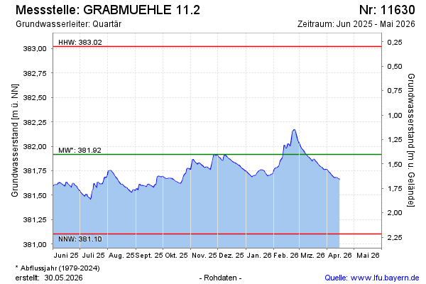
Current data GRABMUEHLE 11.2
Groundwater level [m above sealevel]: 381.66
Distance to surface [m]: 1.66
Last value from 15.04.2026 15:00
Ground level [m above sealevel]: 383.32
| Date | Groundwater level [m above sealevel] |
|---|---|
| 15.04.2026 | 381.66 |
| 14.04.2026 | 381.67 |
| 13.04.2026 | 381.67 |
| 12.04.2026 | 381.68 |
| 11.04.2026 | 381.68 |
| 10.04.2026 | 381.68 |
| 09.04.2026 | 381.68 |
| 08.04.2026 | 381.68 |