
- Start >
- Groundwater >
- Waterlevel of upper layer >
- Obere Donau >
- GERSTHOFEN 650 >
- Chart of total period

Chart of total period GERSTHOFEN 650
Groundwater levels of the total period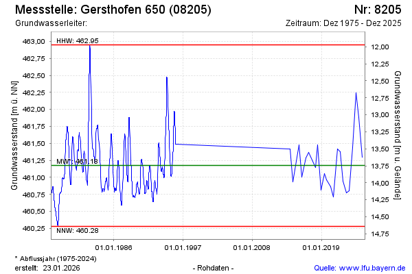
Groundwater level [m above sealevel]: 460.88
Distance to surface [m]: 14.04
Last value from 16.12.2025 10:00
Ground level [m above sealevel]: 474.92
| Date | Groundwater level [m above sealevel] |
|---|---|
| 05.12.2024 | 461.88 |
| 05.07.2024 | 462.24 |
| 15.12.2023 | 461.44 |
| 15.06.2023 | 460.80 |
| 30.11.2022 | 460.77 |
| 20.06.2022 | 460.94 |
| 14.12.2021 | 461.38 |
| 22.07.2021 | 461.42 |
© Bayerisches Landesamt für Umwelt 2026