
- Start >
- Groundwater >
- Waterlevel of upper layer >
- Obere Donau >
- GABLINGEN BHF 55 >
- Chart of total period

Chart of total period GABLINGEN BHF 55
Groundwater levels of the total period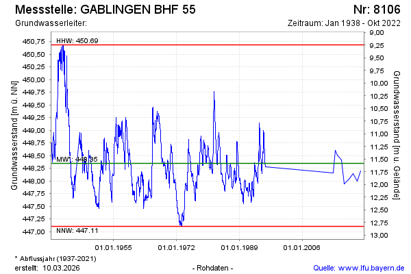
Groundwater level [m above sealevel]: 448.61
Distance to surface [m]: 11.32
Last value from 11.10.2022 10:00
Ground level [m above sealevel]: 459.93
| Date | Groundwater level [m above sealevel] |
|---|---|
| 05.10.2021 | 448.20 |
| 13.10.2020 | 448.00 |
| 26.09.2019 | 448.14 |
| 19.09.2018 | 448.03 |
| 22.05.2017 | 447.94 |
| 06.09.2016 | 448.41 |
| 18.06.2015 | 448.51 |
| 12.11.2014 | 448.60 |
© Bayerisches Landesamt für Umwelt 2026