
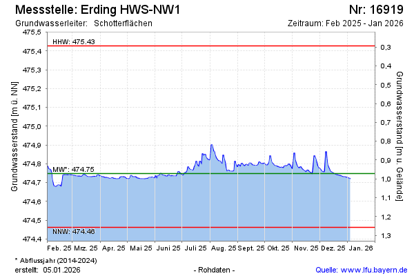
Current data Erding HWS-NW1
Groundwater level [m above sealevel]: 474.80
Distance to surface [m]: 0.92000000000002
Last value from 01.07.2026 10:00
Ground level [m above sealevel]: 475.72
| Date | Groundwater level [m above sealevel] |
|---|---|
| 30.06.2026 | 474.74 |
| 29.06.2026 | 474.73 |
| 28.06.2026 | 474.73 |
| 27.06.2026 | 474.73 |
| 26.06.2026 | 474.73 |
| 25.06.2026 | 474.73 |
| 24.06.2026 | 474.73 |
| 23.06.2026 | 474.73 |