
- Start >
- Groundwater >
- Waterlevel of upper layer >
- Obere Donau >
- EISENMAST R.D.E. 1 >
- Chart of total period

Chart of total period EISENMAST R.D.E. 1
Groundwater levels of the total period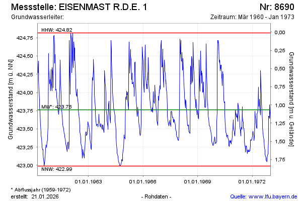
Groundwater level [m above sealevel]: 423.58
Distance to surface [m]: 1.25
Last value from 05.01.1973 12:00
Ground level [m above sealevel]: 424.83
| Date | Groundwater level [m above sealevel] |
|---|---|
| 30.12.1972 | 423.64 |
| 23.12.1972 | 423.72 |
| 15.12.1972 | 423.83 |
| 08.12.1972 | 423.64 |
| 02.12.1972 | 423.67 |
| 25.11.1972 | 423.67 |
| 18.11.1972 | 423.37 |
| 10.11.1972 | 423.15 |
© Bayerisches Landesamt für Umwelt 2026