
- Start >
- Groundwater >
- Waterlevel of upper layer >
- Obere Donau >
- DUENZLAU 123 >
- Chart of total period

Chart of total period DUENZLAU 123
Groundwater levels of the total period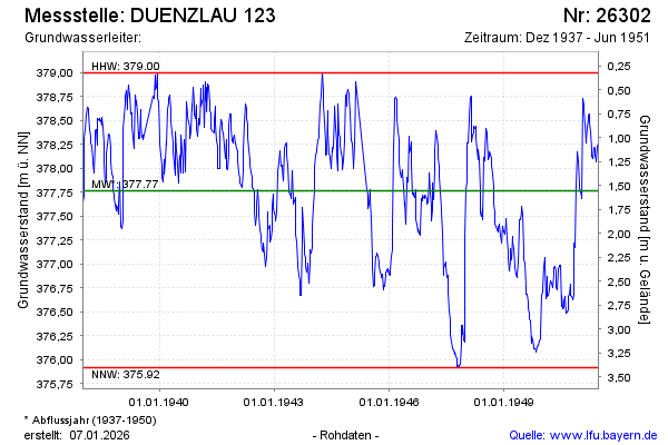
Groundwater level [m above sealevel]: 378.26
Distance to surface [m]: 1.06
Last value from 25.06.1951 12:00
Ground level [m above sealevel]: 379.32
| Date | Groundwater level [m above sealevel] |
|---|---|
| 18.06.1951 | 378.26 |
| 11.06.1951 | 378.23 |
| 04.06.1951 | 378.07 |
| 28.05.1951 | 378.09 |
| 21.05.1951 | 378.13 |
| 15.05.1951 | 378.21 |
| 07.05.1951 | 378.22 |
| 30.04.1951 | 378.10 |
© Bayerisches Landesamt für Umwelt 2026