
- Start >
- Groundwater >
- Waterlevel of upper layer >
- Obere Donau >
- DORNACH 553 >
- Chart of total period

Chart of total period DORNACH 553
Groundwater levels of the total period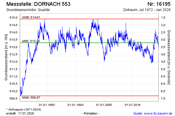
Groundwater level [m above sealevel]: 512.87
Distance to surface [m]: 3.63
Last value from 02.05.2024 09:00
Ground level [m above sealevel]: 516.50
| Date | Groundwater level [m above sealevel] |
|---|---|
| 02.05.2024 | 512.87 |
| 01.05.2024 | 512.87 |
| 30.04.2024 | 512.87 |
| 29.04.2024 | 512.88 |
| 28.04.2024 | 512.88 |
| 27.04.2024 | 512.89 |
| 26.04.2024 | 512.89 |
| 25.04.2024 | 512.89 |
© Bayerisches Landesamt für Umwelt 2024