
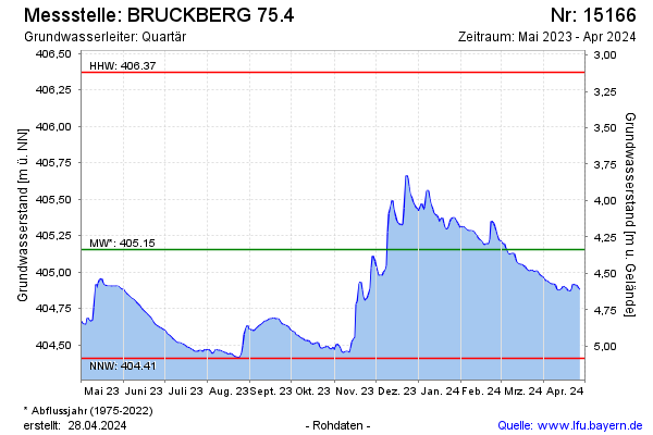
Current data BRUCKBERG 75.4
Groundwater level [m above sealevel]: 404.49
Distance to surface [m]: 5
Last value from 13.07.2026 10:00
Ground level [m above sealevel]: 409.49
| Date | Groundwater level [m above sealevel] |
|---|---|
| 13.07.2026 | 404.49 |
| 12.07.2026 | 404.50 |
| 11.07.2026 | 404.50 |
| 10.07.2026 | 404.51 |
| 09.07.2026 | 404.52 |
| 08.07.2026 | 404.53 |
| 07.07.2026 | 404.54 |
| 06.07.2026 | 404.54 |