
- Start >
- Groundwater >
- Waterlevel of upper layer >
- Obere Donau >
- BOBINGEN X 1 >
- Chart of total period

Chart of total period BOBINGEN X 1
Groundwater levels of the total period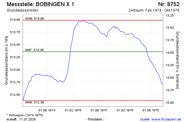
Groundwater level [m above sealevel]: 512.66
Distance to surface [m]: 14.68
Last value from 25.10.1976 12:00
Ground level [m above sealevel]: 527.34
| Date | Groundwater level [m above sealevel] |
|---|---|
| 18.10.1976 | 512.70 |
| 11.10.1976 | 512.77 |
| 04.10.1976 | 512.82 |
| 27.09.1976 | 512.88 |
| 20.09.1976 | 512.92 |
| 13.09.1976 | 512.94 |
| 06.09.1976 | 512.98 |
| 30.08.1976 | 513.03 |
© Bayerisches Landesamt für Umwelt 2026