
Chart of total period BLINDHEIM 39
Groundwater level [m above sealevel]: 410.44
Distance to surface [m]: 0.42000000000002
Last value from 26.10.1992 12:00
Ground level [m above sealevel]: 410.86
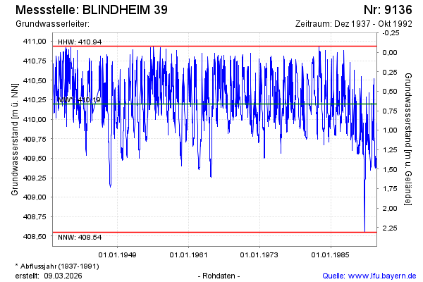
| Date | Groundwater level [m above sealevel] |
|---|---|
| 19.10.1992 | 409.95 |
| 12.10.1992 | 409.73 |
| 05.10.1992 | 409.69 |
| 28.09.1992 | 409.48 |
| 21.09.1992 | 409.48 |
| 14.09.1992 | 409.48 |
| 07.09.1992 | 409.50 |
| 31.08.1992 | 409.42 |