
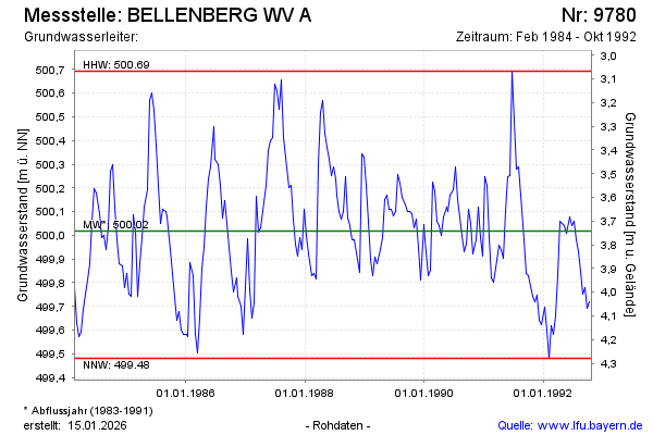
Chart of total period BELLENBERG WV A
Groundwater level [m above sealevel]: 499,75
Distance to surface [m]: 4,01
Last value from 26.10.1992 12:00
Ground level [m above sealevel]: 503.76
| Date | Groundwater level [m above sealevel] |
|---|---|
| 13.10.1992 | 499.72 |
| 29.09.1992 | 499.69 |
| 14.09.1992 | 499.78 |
| 31.08.1992 | 499.75 |
| 18.08.1992 | 499.85 |
| 04.08.1992 | 499.93 |
| 21.07.1992 | 499.98 |
| 08.07.1992 | 500.06 |