
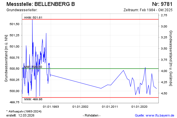
Chart of total period BELLENBERG B
Groundwater level [m above sealevel]: 500.15
Distance to surface [m]: 4.3
Last value from 16.03.2026 15:15
Ground level [m above sealevel]: 504.45
| Date | Groundwater level [m above sealevel] |
|---|---|
| 16.10.2025 | 500.01 |
| 19.02.2025 | 500.05 |
| 24.09.2024 | 500.08 |
| 16.04.2024 | 500.10 |
| 06.09.2023 | 500.39 |
| 22.02.2023 | 499.91 |
| 01.09.2022 | 500.13 |
| 18.02.2022 | 499.94 |