
- Start >
- Groundwater >
- Waterlevel of upper layer >
- Obere Donau >
- BELLENB./ILLERUF. 1701 >
- Chart of total period

Chart of total period BELLENB./ILLERUF. 1701
Groundwater levels of the total period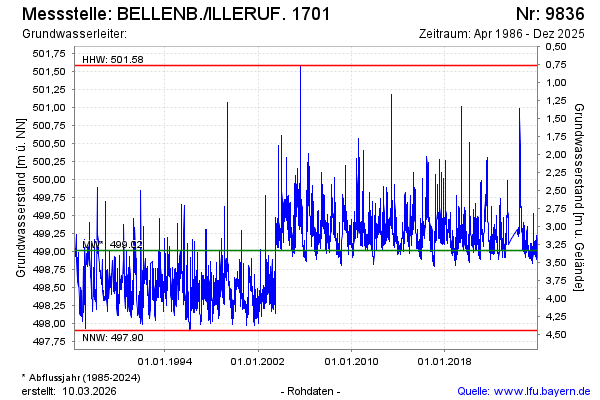
Groundwater level [m above sealevel]: 499.11
Distance to surface [m]: 3.24
Last value from 17.03.2026 13:33
Ground level [m above sealevel]: 502.35
| Date | Groundwater level [m above sealevel] |
|---|---|
| 17.03.2026 | 499.11 |
| 16.03.2026 | 499.13 |
| 15.03.2026 | 499.14 |
| 14.03.2026 | 499.16 |
| 13.03.2026 | 499.17 |
| 12.03.2026 | 499.16 |
| 11.03.2026 | 499.15 |
| 10.03.2026 | 499.17 |
© Bayerisches Landesamt für Umwelt 2026