
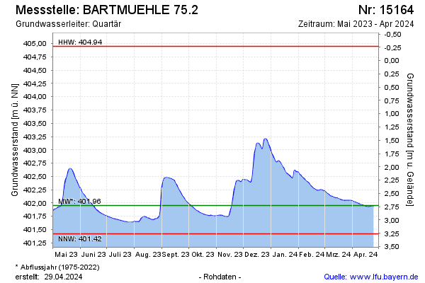
Current data BARTMUEHLE 75.2
Groundwater level [m above sealevel]: 401.90
Distance to surface [m]: 2.78
Last value from 24.06.2026 10:00
Ground level [m above sealevel]: 404.68
| Date | Groundwater level [m above sealevel] |
|---|---|
| 28.06.2026 | 401.89 |
| 27.06.2026 | 401.89 |
| 26.06.2026 | 401.89 |
| 25.06.2026 | 401.90 |
| 24.06.2026 | 401.91 |
| 23.06.2026 | 401.91 |
| 22.06.2026 | 401.91 |
| 21.06.2026 | 401.91 |