
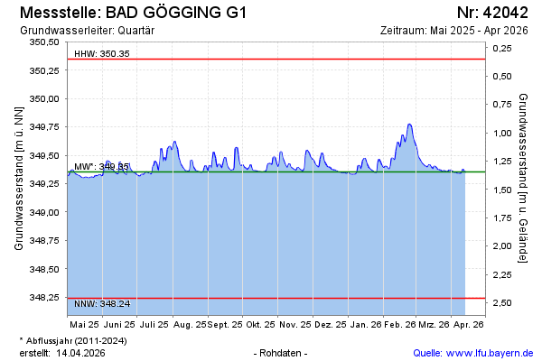
Current data BAD GÖGGING G1
Groundwater level [m above sealevel]: 349.34
Distance to surface [m]: 1.36
Last value from 05.07.2026 10:00
Ground level [m above sealevel]: 350.70
| Date | Groundwater level [m above sealevel] |
|---|---|
| 05.07.2026 | 349.34 |
| 04.07.2026 | 349.35 |
| 03.07.2026 | 349.41 |
| 02.07.2026 | 349.47 |
| 01.07.2026 | 349.42 |
| 30.06.2026 | 349.36 |
| 29.06.2026 | 349.28 |
| 28.06.2026 | 349.27 |