
Chart of total period Auernheim
Groundwater level [m above sealevel]: 524,64
Distance to surface [m]: 25,16
Last value from 12.05.2026 13:00
Ground level [m above sealevel]: 549.80
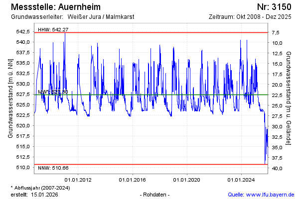
| Date | Groundwater level [m above sealevel] |
|---|---|
| 17.12.2025 | 516.70 |
| 16.12.2025 | 516.22 |
| 15.12.2025 | 515.59 |
| 14.12.2025 | 514.93 |
| 13.12.2025 | 514.18 |
| 12.12.2025 | 513.43 |
| 11.12.2025 | 512.85 |
| 10.12.2025 | 512.57 |