
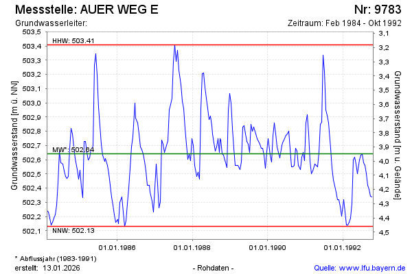
Chart of total period AUER WEG E
Groundwater level [m above sealevel]: 502.33
Distance to surface [m]: 4.26
Last value from 26.10.1992 12:00
Ground level [m above sealevel]: 506.59
| Date | Groundwater level [m above sealevel] |
|---|---|
| 13.10.1992 | 502.34 |
| 29.09.1992 | 502.34 |
| 14.09.1992 | 502.39 |
| 31.08.1992 | 502.42 |
| 18.08.1992 | 502.50 |
| 04.08.1992 | 502.56 |
| 21.07.1992 | 502.58 |
| 08.07.1992 | 502.64 |