
- Start >
- Groundwater >
- Waterlevel of upper layer >
- Obere Donau >
- Ammerfeld, B1 >
- Chart of total period

Chart of total period Ammerfeld, B1
Groundwater levels of the total period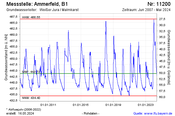
Groundwater level [m above sealevel]: 446.41
Distance to surface [m]: 47.59
Last value from 03.06.2024 06:00
Ground level [m above sealevel]: 494.00
| Date | Groundwater level [m above sealevel] |
|---|---|
| 02.06.2024 | 443.86 |
| 01.06.2024 | 442.39 |
| 31.05.2024 | 442.27 |
| 30.05.2024 | 442.33 |
| 29.05.2024 | 442.37 |
| 28.05.2024 | 442.41 |
| 27.05.2024 | 442.50 |
| 26.05.2024 | 442.59 |
© Bayerisches Landesamt für Umwelt 2024