
Current data ALTMANNSTETTEN 25.02
Groundwater level [m above sealevel]: 378.02
Distance to surface [m]: 1.83
Last value from 09.10.2025 16:00
Ground level [m above sealevel]: 379.85
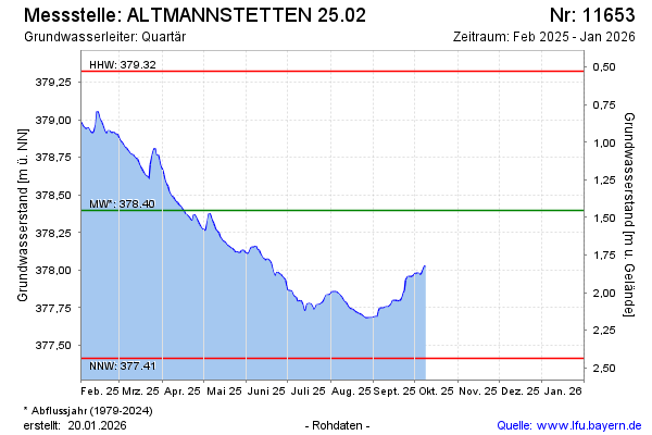
| Date | Groundwater level [m above sealevel] |
|---|---|
| 09.10.2025 | 378.03 |
| 08.10.2025 | 378.02 |
| 07.10.2025 | 378.00 |
| 06.10.2025 | 377.97 |
| 05.10.2025 | 377.97 |
| 04.10.2025 | 377.98 |
| 03.10.2025 | 377.98 |
| 02.10.2025 | 377.97 |