
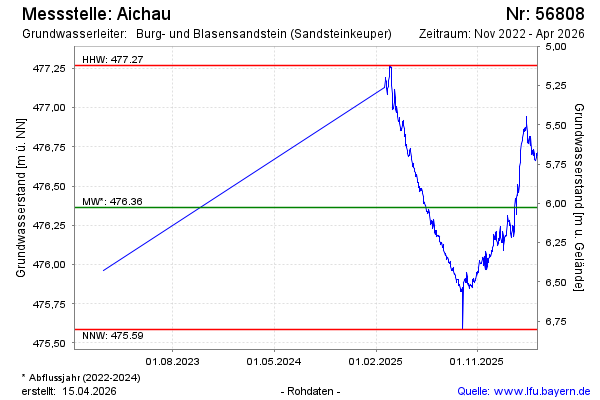
Chart of total period Aichau
Groundwater level [m above sealevel]: 476.13
Distance to surface [m]: 6.26
Last value from 14.07.2026 13:00
Ground level [m above sealevel]: 482.39
| Date | Groundwater level [m above sealevel] |
|---|---|
| 14.07.2026 | 476.14 |
| 13.07.2026 | 476.13 |
| 12.07.2026 | 476.12 |
| 11.07.2026 | 476.14 |
| 10.07.2026 | 476.15 |
| 09.07.2026 | 476.16 |
| 08.07.2026 | 476.17 |
| 07.07.2026 | 476.18 |