
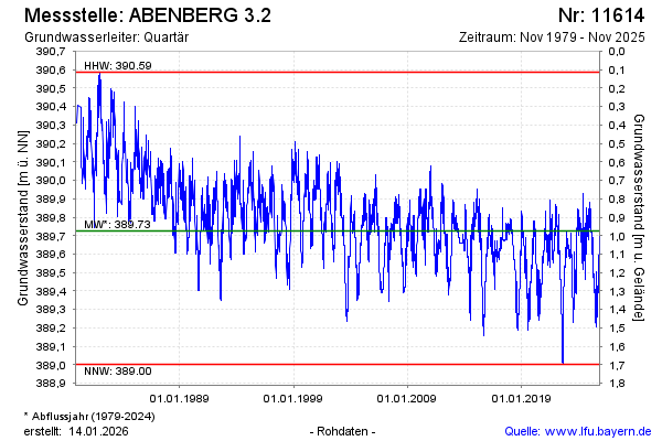
Chart of total period ABENBERG 3.2
Groundwater level [m above sealevel]: 389.56
Distance to surface [m]: 1.14
Last value from 09.04.2026 14:00
Ground level [m above sealevel]: 390.70
| Date | Groundwater level [m above sealevel] |
|---|---|
| 09.04.2026 | 389.56 |
| 08.04.2026 | 389.56 |
| 07.04.2026 | 389.57 |
| 06.04.2026 | 389.57 |
| 05.04.2026 | 389.58 |
| 04.04.2026 | 389.58 |
| 03.04.2026 | 389.58 |
| 02.04.2026 | 389.59 |