
- Start >
- Groundwater >
- Waterlevel of upper layer >
- Isar >
- Winkl 1758A >
- Chart of total period

Chart of total period Winkl 1758A
Groundwater levels of the total period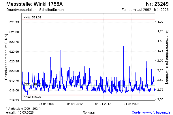
Groundwater level [m above sealevel]: 519.50
Distance to surface [m]: 2.77
Last value from 07.03.2026 09:00
Ground level [m above sealevel]: 522.27
| Date | Groundwater level [m above sealevel] |
|---|---|
| 07.03.2026 | 519.50 |
| 06.03.2026 | 519.50 |
| 05.03.2026 | 519.51 |
| 04.03.2026 | 519.52 |
| 03.03.2026 | 519.53 |
| 02.03.2026 | 519.55 |
| 01.03.2026 | 519.57 |
| 28.02.2026 | 519.60 |
© Bayerisches Landesamt für Umwelt 2026