
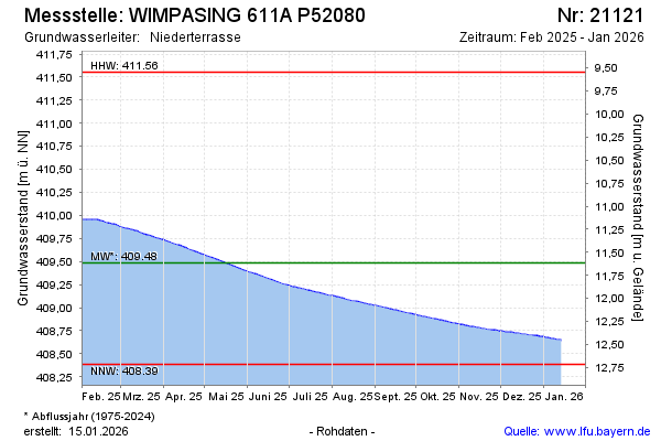
Current data WIMPASING 611A P52080
note
2010 Verlegung der Messstelle wegen Autobahnbau
Groundwater level [m above sealevel]: 408.52
Distance to surface [m]: 12.58
Last value from 24.06.2026 10:00
Ground level [m above sealevel]: 421.10
| Date | Groundwater level [m above sealevel] |
|---|---|
| 29.06.2026 | 408.51 |
| 28.06.2026 | 408.51 |
| 27.06.2026 | 408.51 |
| 26.06.2026 | 408.51 |
| 25.06.2026 | 408.52 |
| 24.06.2026 | 408.52 |
| 23.06.2026 | 408.52 |
| 22.06.2026 | 408.52 |