
- Start >
- Groundwater >
- Waterlevel of upper layer >
- Isar >
- Wielenbach,NR.3 691 >
- Chart of total period

Chart of total period Wielenbach,NR.3 691
Groundwater levels of the total period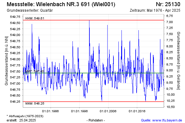
Groundwater level [m above sealevel]: 547.05
Distance to surface [m]: 9.49
Last value from 05.12.2025 21:00
Ground level [m above sealevel]: 556.54
| Date | Groundwater level [m above sealevel] |
|---|---|
| 05.12.2025 | 547.05 |
| 04.12.2025 | 547.04 |
| 03.12.2025 | 547.04 |
| 02.12.2025 | 547.03 |
| 01.12.2025 | 547.03 |
| 30.11.2025 | 547.02 |
| 29.11.2025 | 547.02 |
| 28.11.2025 | 547.01 |
© Bayerisches Landesamt für Umwelt 2025