
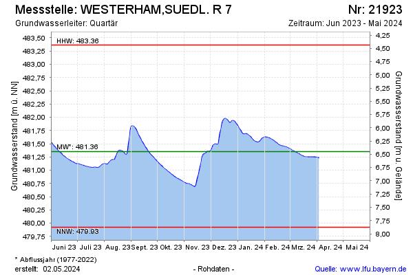
Current data WESTERHAM,SUEDL. R 7
Groundwater level [m above sealevel]: 481.13
Distance to surface [m]: 6.62
Last value from 22.06.2026 09:31
Ground level [m above sealevel]: 487.75
| Date | Groundwater level [m above sealevel] |
|---|---|
| 22.06.2026 | 481.11 |
| 21.06.2026 | 481.12 |
| 20.06.2026 | 481.12 |
| 19.06.2026 | 481.12 |
| 18.06.2026 | 481.12 |
| 17.06.2026 | 481.12 |
| 16.06.2026 | 481.12 |
| 15.06.2026 | 481.12 |