
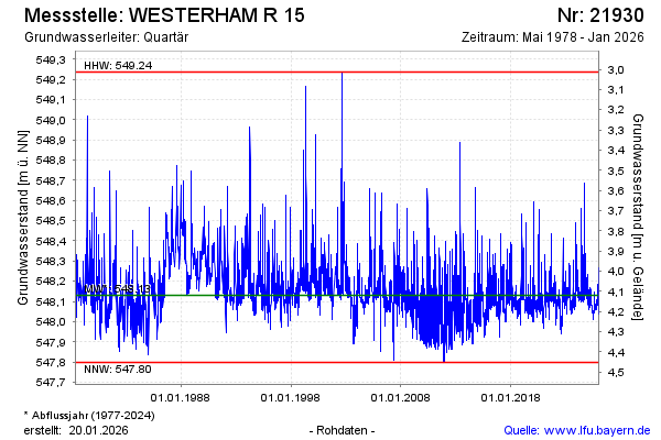
Chart of total period WESTERHAM R 15
Groundwater level [m above sealevel]: 548,03
Distance to surface [m]: 4,22
Last value from 23.07.2026 10:00
Ground level [m above sealevel]: 552.25
| Date | Groundwater level [m above sealevel] |
|---|---|
| 23.07.2026 | 548.03 |
| 22.07.2026 | 548.04 |
| 21.07.2026 | 548.05 |
| 20.07.2026 | 548.07 |
| 19.07.2026 | 548.03 |
| 18.07.2026 | 548.01 |
| 17.07.2026 | 548.01 |
| 16.07.2026 | 548.02 |