
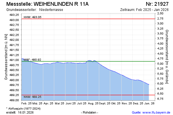
Current data WEIHENLINDEN R 11A
note
Die Messstelle musste 2011 verlegt werden !
Groundwater level [m above sealevel]: 490.52
Distance to surface [m]: 5.3
Last value from 12.07.2026 09:00
Ground level [m above sealevel]: 495.82
| Date | Groundwater level [m above sealevel] |
|---|---|
| 12.07.2026 | 490.53 |
| 11.07.2026 | 490.53 |
| 10.07.2026 | 490.54 |
| 09.07.2026 | 490.54 |
| 08.07.2026 | 490.54 |
| 07.07.2026 | 490.55 |
| 06.07.2026 | 490.55 |
| 05.07.2026 | 490.55 |