
- Start >
- Groundwater >
- Waterlevel of upper layer >
- Isar >
- WEIDACH R 20 >
- Chart of total period

Chart of total period WEIDACH R 20
Groundwater levels of the total period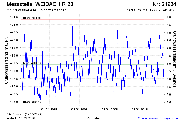
Groundwater level [m above sealevel]: 486.95
Distance to surface [m]: 6.52
Last value from 03.02.2026 10:43
Ground level [m above sealevel]: 493.47
| Date | Groundwater level [m above sealevel] |
|---|---|
| 03.02.2026 | 486.98 |
| 02.02.2026 | 486.98 |
| 01.02.2026 | 486.99 |
| 31.01.2026 | 487.00 |
| 30.01.2026 | 487.00 |
| 29.01.2026 | 487.01 |
| 28.01.2026 | 487.02 |
| 27.01.2026 | 487.03 |
© Bayerisches Landesamt für Umwelt 2026