
- Start >
- Groundwater >
- Waterlevel of upper layer >
- Isar >
- WEICHERING 41.02 >
- Current data

Current data WEICHERING 41.02
Groundwater levels of the last 12 months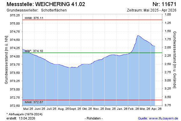
Groundwater level [m above sealevel]: 374.05
Distance to surface [m]: 2.22
Last value from 22.01.2026 10:00
Ground level [m above sealevel]: 376.27
| Date | Groundwater level [m above sealevel] |
|---|---|
| 23.01.2026 | 374.05 |
| 22.01.2026 | 374.05 |
| 21.01.2026 | 374.05 |
| 20.01.2026 | 374.04 |
| 19.01.2026 | 374.04 |
| 18.01.2026 | 374.04 |
| 17.01.2026 | 374.03 |
| 16.01.2026 | 374.03 |
© Bayerisches Landesamt für Umwelt 2026