
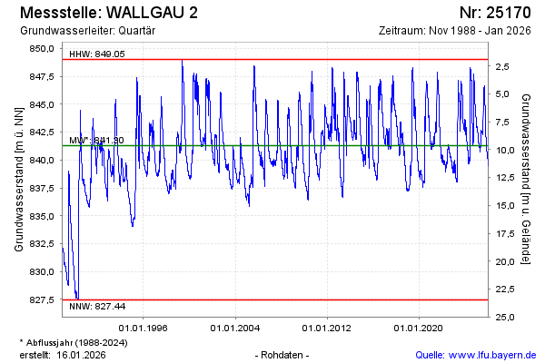
Chart of total period WALLGAU 2
Groundwater level [m above sealevel]: 840.44
Distance to surface [m]: 10.49
Last value from 14.07.2026 23:00
Ground level [m above sealevel]: 850.93
| Date | Groundwater level [m above sealevel] |
|---|---|
| 14.07.2026 | 840.45 |
| 13.07.2026 | 840.48 |
| 12.07.2026 | 840.51 |
| 11.07.2026 | 840.55 |
| 10.07.2026 | 840.59 |
| 09.07.2026 | 840.63 |
| 08.07.2026 | 840.69 |
| 07.07.2026 | 840.76 |