
Current data WALDKRAIBG STA O 745
note
Beobachtung nur mehr halbjährlich
Groundwater level [m above sealevel]: 397,71
Distance to surface [m]: 29,05
Last value from 16.04.2026 12:06
Ground level [m above sealevel]: 426.76
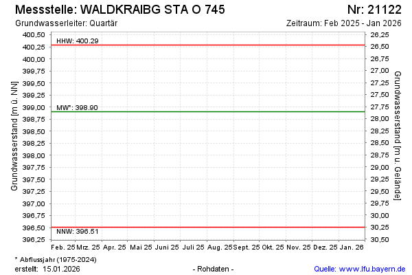
| Date | Groundwater level [m above sealevel] |
|---|---|
| 16.10.2025 | 398.33 |
| 22.04.2025 | 398.93 |
| 10.10.2024 | 398.85 |
| 18.04.2024 | 398.37 |
| 19.10.2023 | 397.41 |
| 01.10.2023 | -- |
| 30.09.2023 | -- |
| 29.09.2023 | -- |