
- Start >
- Groundwater >
- Waterlevel of upper layer >
- Isar >
- WALDERING >
- Chart of total period

Chart of total period WALDERING
Groundwater levels of the total period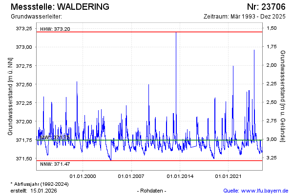
Groundwater level [m above sealevel]: 371.75
Distance to surface [m]: 3.01
Last value from 14.03.2026 11:00
Ground level [m above sealevel]: 374.76
| Date | Groundwater level [m above sealevel] |
|---|---|
| 14.03.2026 | 371.75 |
| 13.03.2026 | 371.75 |
| 12.03.2026 | 371.76 |
| 11.03.2026 | 371.76 |
| 10.03.2026 | 371.77 |
| 09.03.2026 | 371.78 |
| 08.03.2026 | 371.78 |
| 07.03.2026 | 371.79 |
© Bayerisches Landesamt für Umwelt 2026