
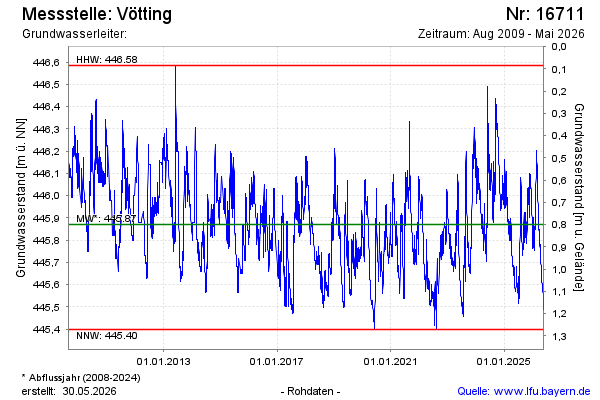
Chart of total period Vötting
Groundwater level [m above sealevel]: 445.56
Distance to surface [m]: 1.11
Last value from 11.07.2026 13:00
Ground level [m above sealevel]: 446.67
| Date | Groundwater level [m above sealevel] |
|---|---|
| 11.07.2026 | 445.56 |
| 10.07.2026 | 445.58 |
| 09.07.2026 | 445.58 |
| 08.07.2026 | 445.59 |
| 07.07.2026 | 445.61 |
| 06.07.2026 | 445.61 |
| 05.07.2026 | 445.60 |
| 04.07.2026 | 445.61 |