
Current data UNTERSCHLEISSHEIM/RATH
Groundwater level [m above sealevel]: 470.29
Distance to surface [m]: 5.42
Last value from 13.07.2026 10:00
Ground level [m above sealevel]: 475.71
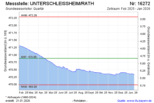
| Date | Groundwater level [m above sealevel] |
|---|---|
| 13.07.2026 | 470.29 |
| 12.07.2026 | 470.30 |
| 11.07.2026 | 470.31 |
| 10.07.2026 | 470.32 |
| 09.07.2026 | 470.33 |
| 08.07.2026 | 470.34 |
| 07.07.2026 | 470.35 |
| 06.07.2026 | 470.36 |